The Chocorua Lake Conservancy achieves the long-term protection of the Chocorua Lake Basin by seeking, holding, and monitoring conservation easements and by accepting land ownership. We want to ensure that the Chocorua Lake Basin’s unique balance between the natural state and mankind is preserved forever. The CLC owns or manages almost 1,000 acres of conservation land across 17 properties in the Chocorua Lake Basin, and protects almost 3,000 additional acres through perpetual conservation easements and covenants on over 100 other properties.
In 2005, the Chocorua Lake Conservancy successfully registered the Chocorua Lake Basin Historic District, which includes 155 historic buildings across 6,000 acres, onto the National Register of Historic Places. You can read more about the Historic District here.
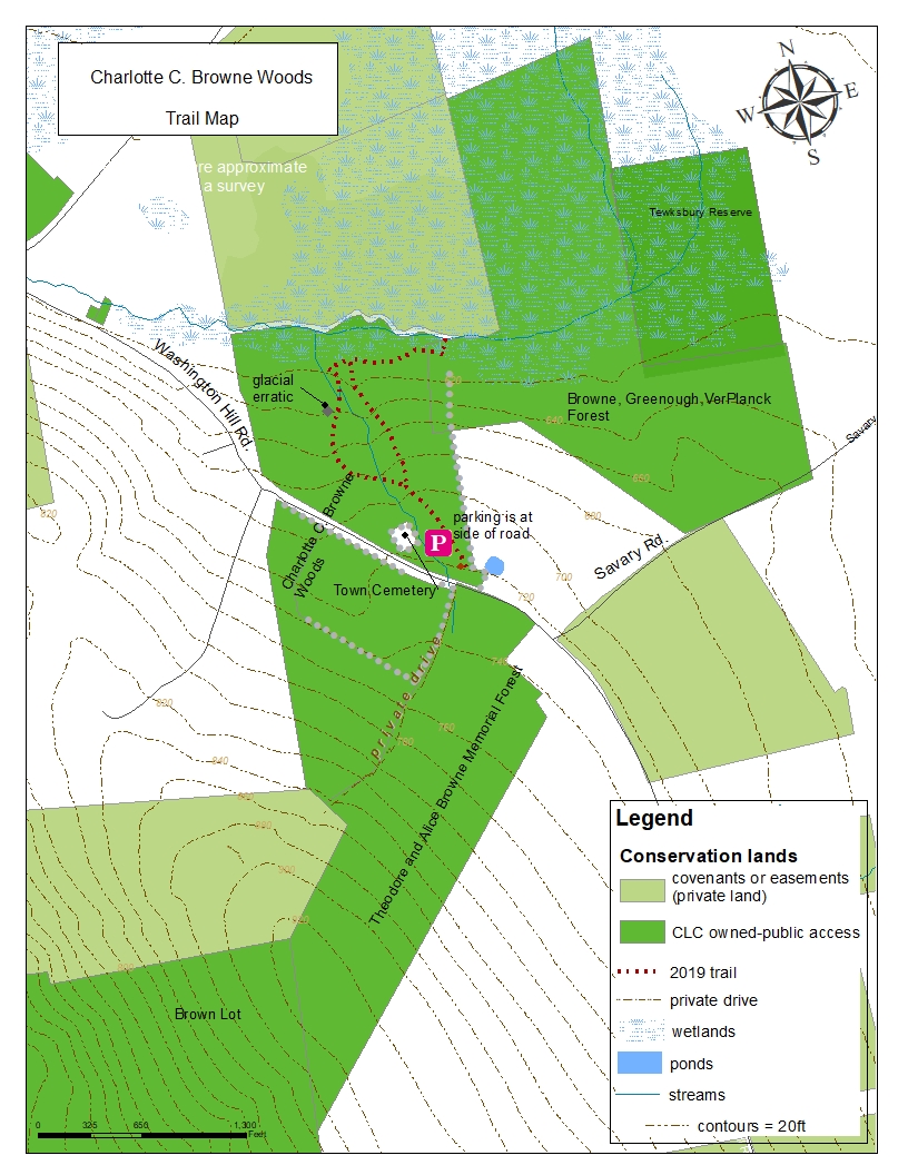
Trail MapS
You are welcome to explore these areas on foot, or on skis or snowshoes. Please note that no fires of any kind, no camping, and no motorized vehicles are permitted on these conservation lands or on the access trails, which cross private property. Please treat this special part of our environment with care.
How many of these trails have you explored? Click on the maps to download PDF versions suitable for printing. You can also find trail maps and descriptions in the Chocorua Map app for iOS.

A big thank you to Rick Allmendinger for this vivid and detailed map of trails and public access areas on CLC lands using LiDAR and bathymetry.
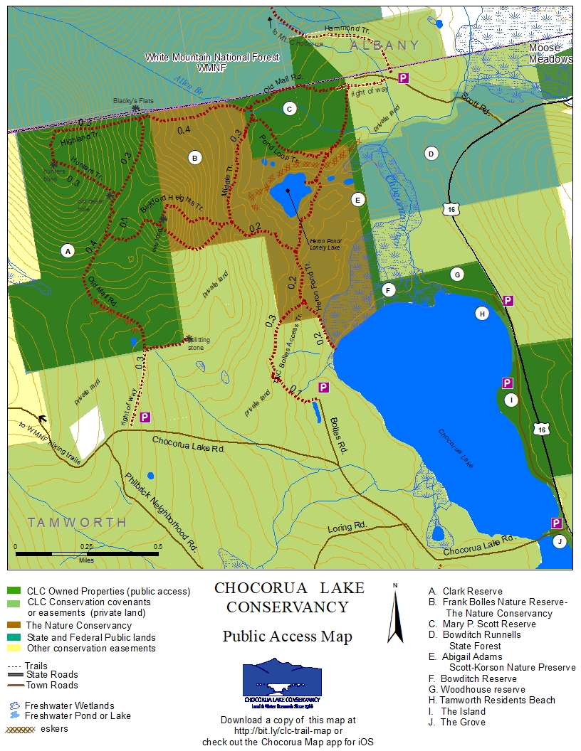
ALL CLC Protected Properties
Click on the map to download a PDF version suitable for printing.
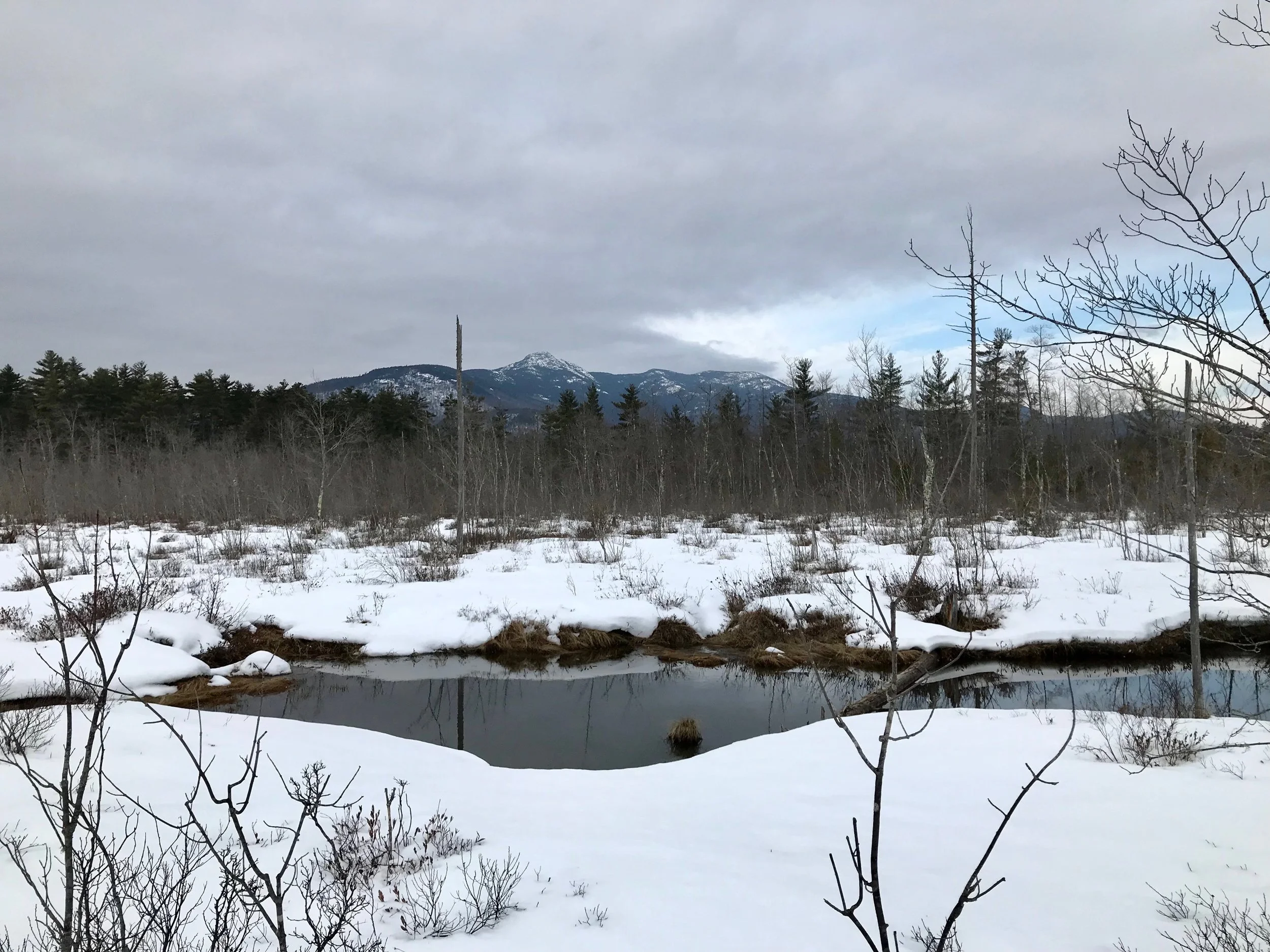
Banner: Mount Chocorua from the Charlotte C. Browne Woods. Photo: Juno Lamb