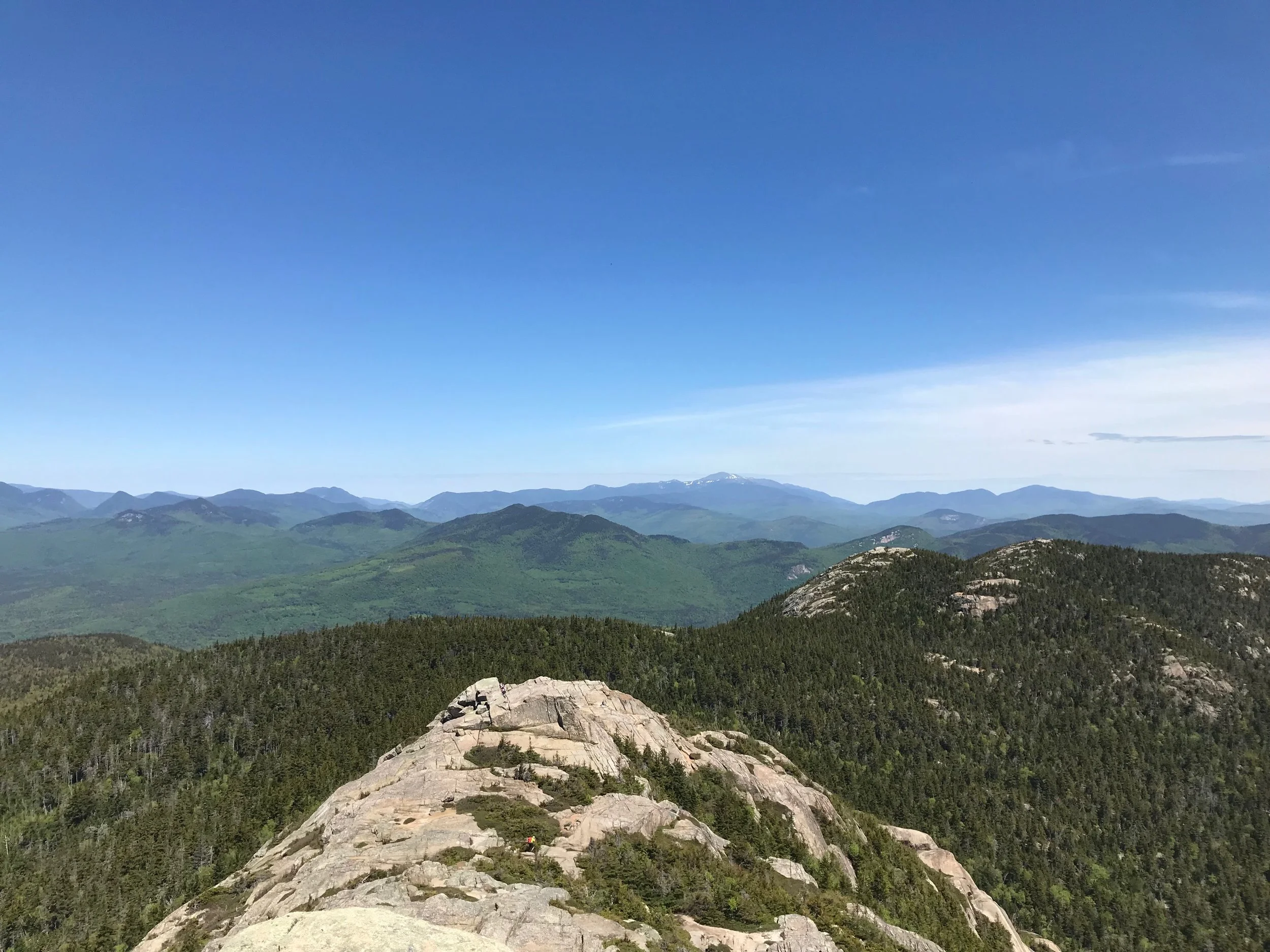

View from near the top of Mount Chocorua, looking toward the Sandwich Range. Photo: Juno Lamb
Mount Chocorua (3,490 feet elevation) is one of New Hampshire’s most frequently hiked, well-known, and easily recognizable mountains. It has a substantial network of trails; several trails are very heavily used, but it is usually possible to avoid crowds (until you reach the summit) by taking less popular trails. The Appalachian Mountain Club reports that Mount Chocorua is one of the most photographed mountains in the world.
Mount Chocorua is the easternmost peak of the Sandwich Range and at the southern end of the White Mountains. Its distinct, rocky summit is the result of a series of forest fires between the early 19th and 20th centuries. From its bare peak, hikers have excellent views of the surrounding lakes, mountains, and forests. Adjacent to Mount Chocorua are the the Three Sisters (First Sister 3,354', Middle Sister 3,340', Third Sister 3,320'). Mount Chocorua is part of the 6,100-acre Mount Chocorua Scenic Area, which was created in 1986 as part of the White Mountain Forest Plan.

Rhodora, rhododendron canadense, blooming on the Liberty Trail, Mount Chocorua. Photo: Juno Lamb
Hiking Trails
Although Mount Chocorua is lower in elevation (3,490') compared to other major White Mountain peaks, its trailheads are located at low elevations, resulting in a substantial elevation gain that makes Mount Chocorua as strenuous a hike as many much higher peaks. Any of the round trip options to the summit are over seven miles in total length and will take six hours or more. These hikes are recommended for moderate to strong hikers only.
The extensive areas of open ledge that make Mount Chocorua so attractive can also be dangerous. Many of the trails have ledgy sections can dangerous when wet or icy, and the summit and upper ledges are severely exposed to lightning during electrical storms.
NH hikeSafe Program
Before attempting any hike, please read about the Ten Essentials and the NH hikeSafe Program HERE.
Recommended Trail Maps & Guidebooks
Please consult a good hiking guide and bring a trail map with you when hiking Mount Chocorua.
We recommend:
Chocorua Mountain Club (CMC) trail map (for sale in local stores in Chocorua and Tamworth)
White Mountain Guide (Appalachian Mountain Club)
White Mountain National Forest Map Set (Appalachian Mountain Club)
Exploring New Hampshire Map (Wilderness Map Company)
Chocorua Map App
The Chocorua Map app for iOS includes maps and trail descriptions for all of these Mount Chocorua trails, as well as for trails in the Chocorua Lake Basin.
Trail Descriptions
Please be aware that trails can change over time and these descriptions may not accurately represent current trail conditions.
Chocorua Mountain Club
The Chocorua Mountain Club (CMC) is responsible for clearing and maintaining seven trails on Mount Chocorua and Mount Paugus. CMC members also help maintain trails on Conservancy-owned and Conservancy co-managed conservation lands. If you love to hike Mount Chocorua, please consider getting involved with the CMC and helping to support and maintain these trails.
Legend of Chief Chocorua
Legend has had it that Mount Chocorua was named for a Native American Chief Chocorua. While the Legend of Chief Chocorua has been written and depicted in many forms, little historical evidence backs up the legend or that the mountain is named for any person. You can read more about where Chocorua may actually have gotten its name here.
Banner: Looking north toward Mount Washington from the top of Mount Chocorua. Photo: Juno Lamb