14,500 years ago, Tamworth and the surrounding area was covered by nearly a mile of ice. What happened after that?
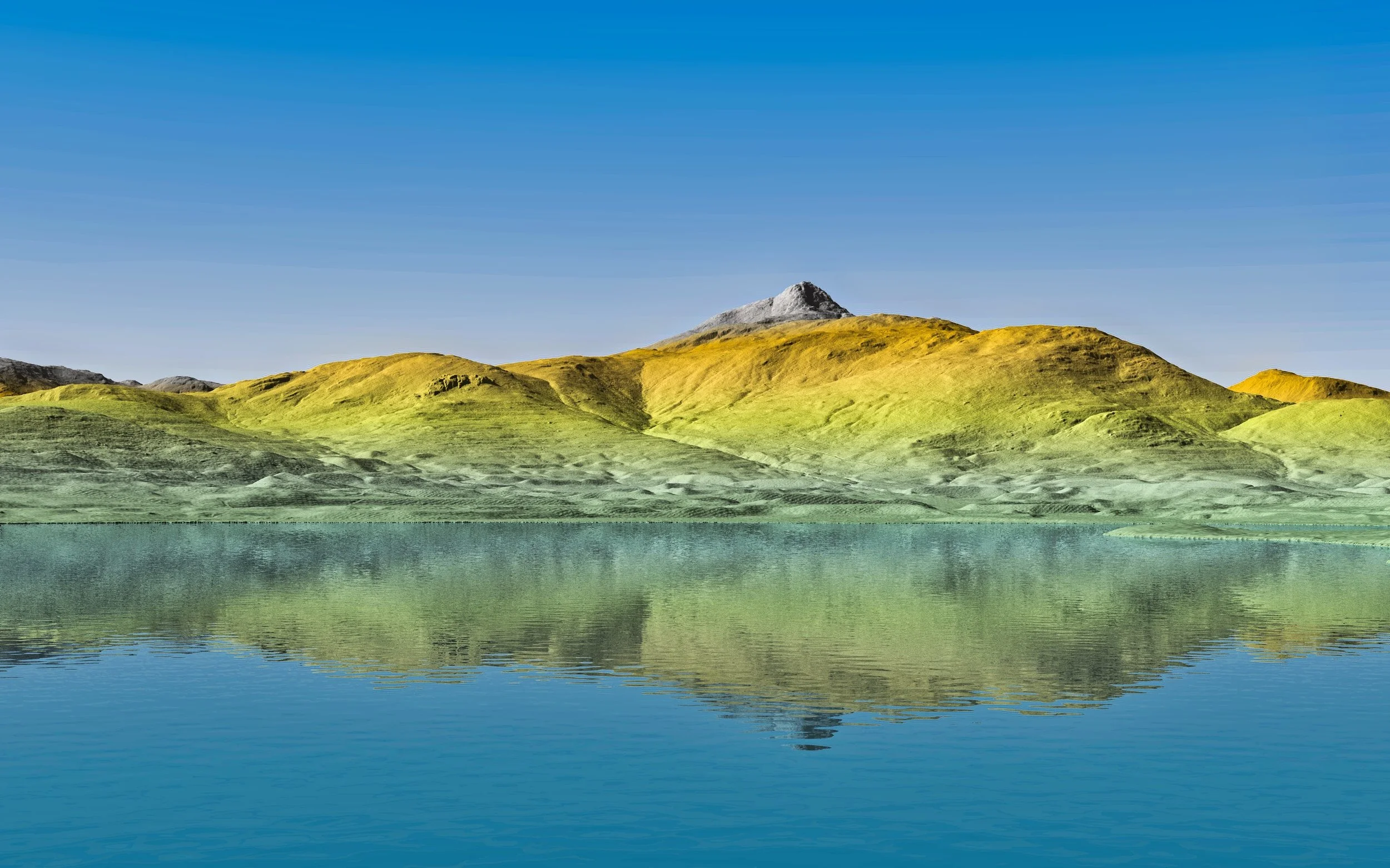
Join the Chocorua Lake Conservancy at the Cook Memorial Library for “Timeless is Relative: The Glaciated Landscape of the Chocorua Basin,” with geologist Rick Allmendinger. As timeless and unchanging as Chocorua Lake may appear to us in our lifetimes, new, high-resolution topographic imaging (LiDAR) of the basin reveals that the lake was once nearly twice as large and 50 feet deeper than it is today. The Earth has experienced profound changes in the last 25,000 years and the record of deglaciation of the Chocorua basin is especially well displayed in this new LiDAR data set. With these data, collected with airborne lasers, we can digitally strip away the vegetation, showing in exquisite detail the shape of the landscape, as well as human features such as stone walls, cellar holes, and old logging roads in the woods. These same data allow us to piece together the evolution of the basin from a time when nearly a mile of ice covered the region to present day.
In this talk, Professor Allmendinger will use the LiDAR to offer a plausible interpretation of the sequence of events that occurred within the basin during the deglaciation of the region between 14,500 and 14,000 years ago, including the location and extent of the precursors to the current Big and Little Lake Chocorua. The story he will describe, a splendid example of natural climate change, unfolded as humans were discovering the New World for the first time. To complement this record of natural global climate change, the talk will conclude with a few brief remarks about what climate models portend for the next 80 years.
Rick Allmendinger is a Professor of Earth and Atmospheric Sciences at Cornell University. He is by training a structural geologist and has spent most of his career working in the Andes and the western United States. Nonetheless, he is a New Hampshire native by birth and his family have owned property in the basin for nearly 100 years. His first professional geology job was mapping glacial deposits and bedrock units in northeastern Massachusetts for the USGS under the direction of Gene Boudette, who later became State Geologist of New Hampshire. At Cornell, he teaches courses in structural geology, regional geology, and energy and climate change.
LiDAR image of Chocorua Lake and Mount Chocorua, courtesy of Rick Allmendinger

